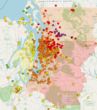
There seems to be some disbelief that the wildfire season could be coming to an end this year. PM2.5 monitors are still showing unhealthy conditions in many areas of the state. Fortunately, the weather models continue to show fall weather on its way with significant precipitation lasting several days. If you look at the precipitation accumulation expected over the next 24 hours, there's really nothing to speak of. But check out the expected totals over the next 60 hours:
Precipitation accumulation for Thursday thru Saturday afternoon. NAM model, courtesy of windy.com
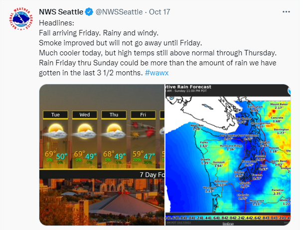
It's going to be tough for any wildfires to stay active much longer with all the cool/moist air on its way. Some of that precipitation will be snow in the mountains! Here is the latest update from the NWS:
"Big weather changes are expected Friday for the Inland Northwest, with a strong cold front bringing colder temperatures, snow, and breezy winds. Mountainous regions will see the first snowflakes of the season. Snow levels will fall between 4000 and 5000 feet Saturday and 2500-3500 feet Sunday. Additionally, the significant cooldown will result in freezing temperatures. Now is the time to prepare for more typical late-October conditions."
On Sunday, you will likely notice a lack of precipitation, and maybe think there wasn't enough to douse the fires. However, there is precipitation forecasted in the Cascade mountains (and Western WA) nearly every day of next week!
All Air Quality Alerts currently in place are set to expire today or tomorrow, note there are new updates below:
Western Washington:
Clallam, Mason, Thurston, Clark, Cowlitz, Lewis, Skamania, Wahkiakum, Island, Jefferson, King, Kitsap, Pierce, Skagit, Snohomish, and Whatcom counties (update, AQA now ends 10 am on Friday)
San Juan county (AQA still ends midnight tonight)
Central Washington:
Chelan, Douglas, Kittitas (new, due to local Rx burning), and Okanogan counties (AQA ends midnight on Friday)
Eastern Washington
Spokane, Stevens, and Pend Oreille counties (AQA ends midnight tonight)









.png)
.png)
.png)
.png)


