Tuesday, October 25, 2022

2022 Wildfire smoke season in review

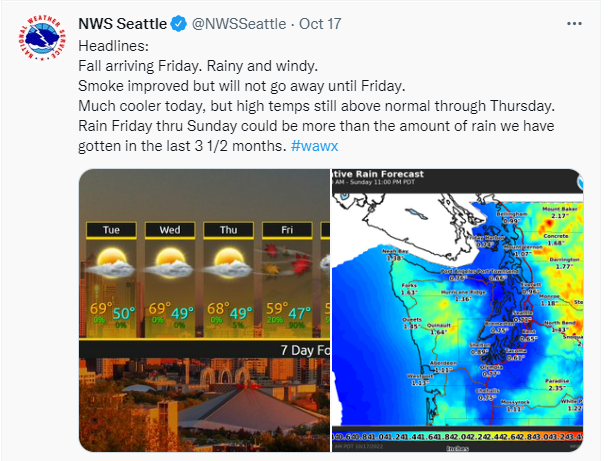
It’s the end of October, and while there are still a few active fires, it looks like the rain is here to stay. We wanted to review the most recent smoke event and put this wildfire season into context in comparison with previous years.  

Ecology's Air Monitoring Coordinator, Jill Schulte, put together these useful maps to look at the frequency and duration of smoke events. She used the daily Hazard Mapping System (HMS) smoke polygons developed by the National Oceanic and Atmospheric Administration’s (NOAA’s) Office of Satellite and Product Operations. 

These polygons use daily GOES satellite imagery to categorize the density of smoke as light, medium, or heavy. Polygons categorized as heavy are more likely to indicate the presence of ground-level smoke. To make these maps, the daily heavy HMS smoke polygons during wildfire season were overlaid with 4km grid cells, and the number of days each grid cell intersected (at any part of the grid cell) a heavy smoke polygon were counted. 

The first map below shows the average number of heavy wildfire smoke days from 2015-2021—you can really see how different parts of the state have been impacted by wildfire smoke over the years, with some locations experiencing on average over 20 days of wildfire smoke per year.

The second map below describes the number of heavy wildfire days just in 2022—you can easily identify the locations of the active fires that led to prolonged smoke impacts in western and central WA.

So how did 2022 measure up? 

Another way to put this wildfire season into context is to look at how many Washingtonians were exposed to extended periods of unhealthy air in comparison to other recent smoke events. 

The number of people exposed to unhealthy or worse air quality (daily PM2.5 average of > 55 micrograms per cubic meter) in 2022 is comparable to the smoke-filled days of 2017, 2018, and 2020.

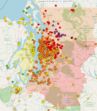
One difference between 2022 and previous years is the duration of the smoke event. While the smoke lingered for much longer than we hoped this year, the majority of Washingtonians were exposed to unhealthy or worse air for less than 5 days. A smaller fraction of the state (those located closest to active fires including the areas of Darrington, Leavenworth, and Wenatchee) were exposed to unhealthy or worse air for 10-14 days.


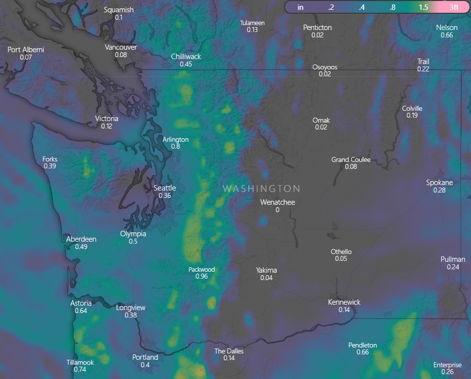
And finally we can take a look at an updated PM2.5 cumulative exposure plot. Last we checked in early October, average statewide concentrations in 2022 were middling compared to those of the last 10 years. A week of heavy smoke makes an impact—an updated analysis below shows that average statewide PM2.5 concentrations are greater than most years in the past decade. Average cumulative 2022 PM2.5 concentrations as of 10/25/2022 are only less than 2017, 2018, and 2020—years with larger fires or smoke that blanketed the entire state for weeks.

Thursday, October 20, 2022

Yes, rain (and snow) is on its way

There seems to be some disbelief that the wildfire season could be coming to an end this year. PM2.5 monitors are still showing unhealthy conditions in many areas of the state.  Fortunately, the weather models continue to show fall weather on its way with significant precipitation lasting several days.  If you look at the precipitation accumulation expected over the next 24 hours, there's really nothing to speak of.  But check out the expected totals over the next 60 hours:

Precipitation accumulation for Thursday thru Saturday afternoon. NAM model, courtesy of windy.com

It's going to be tough for any wildfires to stay active much longer with all the cool/moist air on its way.  Some of that precipitation will be snow in the mountains!  Here is the latest update from the NWS:

"Big weather changes are expected Friday for the Inland Northwest, with a strong cold front bringing colder temperatures, snow, and breezy winds. Mountainous regions will see the first snowflakes of the season. Snow levels will fall between 4000 and 5000 feet Saturday and 2500-3500 feet Sunday. Additionally, the significant cooldown will result in freezing temperatures. Now is the time to prepare for more typical late-October conditions."

On Sunday, you will likely notice a lack of precipitation, and maybe think there wasn't enough to douse the fires.  However, there is precipitation forecasted in the Cascade mountains (and Western WA) nearly every day of next week!  

All Air Quality Alerts currently in place are set to expire today or tomorrow, note there are new updates below:

Western Washington:

Clallam, Mason, Thurston, Clark, Cowlitz, Lewis, Skamania, Wahkiakum, Island, Jefferson, King, Kitsap, Pierce, Skagit, Snohomish, and Whatcom counties (update, AQA now ends 10 am on Friday)

San Juan county (AQA still ends midnight tonight)

Central Washington:

Chelan, Douglas, Kittitas (new, due to local Rx burning), and Okanogan counties (AQA ends midnight on Friday)

Eastern Washington 

Spokane, Stevens, and Pend Oreille counties (AQA ends midnight tonight)

Tuesday, October 18, 2022

Statewide smoke update: lingering smoke impacts but the rain is arriving soon

Good news: The rainy season is almost upon us. Forecasts are looking very promising for a fall storm arriving later this week. 

Bad news: We still have to get through a few more days of smoke impacts before the rain arrives. 

This morning's satellite image:


In Western Washington, light winds will lead to continuing smoke impacts from the lingering fires in the north Cascades, with the potential for unhealthy for sensitive groups to unhealthy in the Puget Sound region. Poor air quality near active fires (including the Loch Katrine, Suiattle, and Bolt Creek fires) will continue this week as well.

In Southwest Washington, the Nakia Creek Fire is currently contributing to deteriorating air quality.

 Rainy and windy conditions begin on Friday.

East of the Cascades, smoke impacts will continue in already impacted areas, including the Wenatchee and Methow Valleys, ranging from moderate to unhealthy, with the heaviest impacts near active fires. Light winds are likely to persist through Thursday until the fall precipitation event begins and continues through the weekend. 

_____________________

Most of the Air Quality Alerts that were in place over the weekend have been extended through Thursday. 


Friday, October 14, 2022

Friday AM Update for the Central Puget Sound: leftovers, and a smoky weekend...

Unfortunately, smoke still lingers in the Puget Sound region. We didn't get much clearing last night and started today off with mostly UNHEALTHY FOR SENSITIVE GROUPS and some UNHEALTHY and MODERATE air quality readings. The Bolt Creek, White River, and Suiattle River fires are the main contributing factors, as well as some from the North Cascades fires.

See the satellite image below from 10 AM:


Keep in mind that some of the thickness (opacity) of the plumes you see is water on the smoke particles. These particles will dry out and thin a bit with the sun and warmer temps. We didn't get much clearing overnight, or at least as much as we've had some of our past few nights, so the Lynnwood-Tacoma corridor is starting off  in the mostly UNHEALTHY FOR SENSITIVE GROUPS range. I do expect some winds this afternoon to help disperse and thin out the smoke a bit and push it south and east, but overall, I don't think we'll get a good clearing. 

The longer-term concern is that tonight through Sunday, easterly winds should pick up in the Cascades, and the central Puget Sound is expected to get a fairly direct feed from the Bolt Creek and White River fires. There is major concern for smoke impacts, and also for flaring up of the fires (which isn't in my prediction skill set). The Suiattle River fire will also be impacting SR 530 and Darrington fairly directly with UNHEALTHY air quality expected through Sunday. The US 2 corridor is also likely to have UNHEALTHY air quality, while the rest of Puget Sound will probably be in UNHEALTHY FOR SENSITIVE GROUPS or UNHEALTHY levels. The smoke could easily push further west into Mason and Jefferson Counties, and further south into Thurston and Lewis Counties. 

Later Saturday and into Sunday (15th and 16th), the winds are likely to shift a bit more to the northwest, so the smoke should head out to the Strait. The south Sound may get a break from the direct supply of smoke earlier than the north, but it's unclear how much improvement they'll see. In any case, no major clearing event is expected and Monday could return to our day-night 'sloshing' with smoke overnight and modest clearing during the daytime hours. 

The major pattern change we're hoping for is expected by next Saturday or Sunday (22nd or 23rd).

_____________________________________

If you plan on traveling to the Okanogan-Wenatchee forest for hunting season, be aware that Stage 1 burn restrictions are in effect. Campfires are ONLY permitted in designated campgrounds and wilderness areas due to increased risk of fires. 

ALWAYS check for burn bans before lighting a campfire. Many other burn bans are in place around the state. You can find additional information on burn bans on Ecology's Burn Ban webpage. 

Also, there are numerous Air Quality Alerts in effect throughout the weekend and into Monday in much of the state. 

Use the blue horizontal scroll bar on the map above this post for the 5-day smoke forecast and to check air quality monitors.

Visit the Health Information tab on this page for tips on how to protect yourself. Meanwhile, help keep the air you breathe clean by keeping doors and windows closed, setting your vehicle's AC to 'recirculate' and making a clean air fan:  


Wednesday, October 12, 2022

Statewide data roundup: smoke in October and regional comparisons

Usually by this time in October we’re thinking about rain, Halloween, and all things fall. We’re certainly not discussing wildfire smoke (or the Mariners!). Wildfire smoke impacts in Washington State usually occur in August and September. Average statewide fine particle (PM2.5) concentrations since 2000 agree with this assessment—and this year we are observing higher than usual PM2.5 concentrations in October. The figure below shows daily average PM2.5 data for all statewide monitoring sites since 2000, with the years 2000-2021 in grey and 2022 highlighted by the red trace.


Phil’s annual accumulation plots posted the other day are a great illustration of the cumulative exposure to PM2.5 throughout the year. Looking at average statewide PM2.5 concentrations, while 2022 is gradually increasing in exposure thanks to the past few weeks, the cumulative average PM2.5 concentration is less than recent years with larger fires or smoke that blanketed the entire state for weeks (i.e., 2017, 2018, and 2020).


And what about different regions in 2022? Smoke impacts started later in the year for most of the state with minimal impacts before September, and Central Washington has seen the worst of the smoke thanks to its proximity to the most active fires.

Looking at a few Central Washington air quality monitoring sites that have been most impacted this season, these graphics are a great tool to visualize how wildfire smoke over the course of a few weeks impacts the total PM2.5 exposure. The horizontal red line on each panel is the annual National Ambient Air Quality Standard for PM2.5 (we want to be well below this line!), and each point is the daily average colored by its respective AQI category.


Unfortunately, impacts from active fires in the Cascades continue in the Methow, Wenatchee, and western mountain valleys. The Puget Sound may also be impacted by wildfire smoke starting tomorrow. Check back here for more information and be sure to take a look at DOH's answers to questions about health impacts of wildfire smoke.

Tuesday, October 11, 2022

We’re talking wildfire smoke & health…in October

We’re getting questions from you all about health, so here we go.

What are the symptoms?

Exposure to wildfire smoke can cause health problems that range from minor to severe. Some symptoms include:

  • Eye, nose, and throat irritation (burning eyes and runny nose)
  • Fatigue
  • Headache and coughing
  • Wheezing and shortness of breath
  • Worsening of existing conditions, especially heart and lung diseases
  • Asthma attacks, chest pain, or irregular heartbeat

For people with health conditions symptoms can be serious, with increased risk of hospitalization or death. But smoke is not good for anyone to breathe. Health impacts can continue through the week following a wildfire smoke event . Continue to monitor symptoms and don’t delay care if needed.

What about the long-term impacts of smoke?

While there is a lot of evidence about the short-term impacts of wildfire smoke up to a week after exposure, the longer-term health impacts from wildfire smoke are not well known, though this research is emerging after increasingly smoky summers.

However, the research is clear that breathing in PM2.5 (the main component of smoke) even at low levels is not good for health.

Who’s most affected?

There are groups of people more sensitive to smoke, but that list includes more than just health conditions, and likely includes you or someone close to you. 

  • People with heart and lung disease, people over 65 and under 18, pregnant people, outdoor workers, people of color, tribal and indigenous people, and people with low income.

What about masks?

It’s tough to stay inside all the time with extended periods of smoke. A properly fitted, NIOSH-approved respirator can reduce your exposure to smoke if you have to be outside. KN95 masks or other masks that are approved in other countries may not provide the same protection as NIOSH-approved respirators because they are not regulated in the United States. If using a KN95 mask, look for ones that meet requirements similar to NIOSH-approved respirators. Cloth face coverings, surgical masks, and masks with filter inserts generally do not provide much protection from breathing in smoke.

For more information see the Health Tab or go to www.doh.wa.gov/smokefromfires.

Monday, October 10, 2022

We love summer and all, but how about some fresh air?

Monday Morning has started off with much of the Central Puget Sound getting wildfire smoke and having air that is UNHEALTHY FOR SENSITIVE GROUPS with some areas in the foothills well into the UNHEALTHY and some spikes of  VERY UNHEALTHY. See our Sensor Map image below.


The weather pattern that gives us our awesome summer days has decided to stick around... far ... too ... long (for when we have wildfires nearby). Now, don't get me wrong, I love summer and all, but this pattern usually breaks down in September and we start getting occasional rain, or the switch flips to perm-a-rain. But this year we may be headed for a record, as others have discussed. But, we should be getting a bit of a break for the next day or two as a solid wind should start this afternoon into the evening, and push everything back to the east. The Puget Sound and western WA should have a significant improvement later today. But the switch still hasn't flipped, and we may not get that for another week... 

What does this extended summer mean for our air quality and how does this compare to other years, especially the big event of 2020? One way to get a sense for this is the annual accumulation of exposure. The EPA's designated National Ambient Air Quality Standard (NAAQS) uses the annual average as a key measure of health risk from fine particles (PM2.5). So, we can look at how our exposure adds up for a whole year and approaches the NAAQS. See the figure below.


Here, we see how over the course of a year, each day adds to our cumulative exposure (or average). Each day is colored by the AQI category that we would use on a forecast for that day. [Green is GOOD, Yellow is MODERATE, orange in UNHEALTHY FOR SENSITIVE GROUPS, red is UNHEALTHY, purple is VERY UNHEALTHY] We need to keep that annual number under 12, and ideally it would be even lower. To give a general sense, I'm showing data from Marysville and North Bend. The Marysville 2020 data shows the full year, and the major wildfire smoke event is obvious with the big jump with reds and a purple. Most of the Puget Sound looked very similar to this curve.  The annual average was over 10, but didn't hit 12. 

By comparison,  the smoke from the Bolt Creek Fire this year is more localized with the US2 corridor and the Cascades getting a much bigger hit. Marysville hasn't had as big of jump as 2020, but has been moving up faster in the last two weeks. North Bend shows one of the biggest recent increase of all of our network, but it is still below the 2020 spike. Assuming our typical PNW fall weather eventually returns, our curves will flatten out and we should still be under 10 ug/m3 for most areas. That said, some days and some places can be still be UNHEALTHY or worse for the next week or so, so people still need to be ready to take some precautions until the fires are really out for the winter. 

Friday, October 7, 2022

Stagnant Air Through Weekend, Brief Period of Relief for Monday Evening/Tuesday Morning

 The warm and dry start to October continues

Another sunny and warm weekend is in store for Washington as a stubborn high pressure system remains firmly in place over the region. By Monday afternoon, a dry cold front will drop out of Canada and sweep across Washington, bringing gusty winds to most areas of the state by Monday around sunset. These winds will be strongest in the Juan de Fuca Strait and in the Cascade Valleys. This will provide good ventilation conditions and should clear smoke out for Monday night and Tuesday morning. 
ECMFW forecast sustained winds for Monday evening. These winds will temporarily clear smoke from the Puget Sound and Cascade valleys. 

After the brief respite early in the week, a similar pattern to this week develops by Tuesday afternoon and continues through the foreseeable future. Smoke conditions will return and air quality conditions in the 'unhealthy' category are likely for the Wenatchee Valley. Even with no rain, smoke production on active fires will begin to slowly decrease as longer nights and cooler days set in. We are in the midst of the driest and warmest October since at least 1987, so this pattern is decidedly not normal. 

Active management continues on all ongoing fires in Washington, and firefighters have made great progress in containing the amount of timber the fires have available to burn. Unfortunately, it takes widespread wetting rain to truly extinguish these fires. Just 1 inch of rain falling on the area of the Bolt Creek fire is equivalent to dumping 353 million gallons of water, the scale that mother nature works on is truly astounding. 

Tuesday, October 4, 2022

High Pressure Trapping Smoke, Impacts Through Weekend

 A warm, stable airmass is stuck in place over Washington

Mid-level ridging is firmly entrenched over Washington for the next 5-7 days, providing warm temperatures, clear skies, and light winds for nearly the entire state. When we get patterns that have very little wind associated with them, daily wind patterns are dictated by terrain. In the afternoons, air heated along the mountain slopes tends to rise, yielding upslope winds. At night, the air more rapidly cools in the mountains and drains out through the valleys, yielding downslope winds. These downslope winds at night are the primarily driver for bringing low level smoke into the Puget Sound region, as well as into the Wenatchee Valley. 

       The "Omega Block" pattern is responsible for our warm and dry pattern with little wind this week

With very little wind outside of the daily upslope/downslope pattern, smoke can very easily get trapped in valleys and drainages. The worst smoke impacts through this weekend will be along Highway 2, spreading eastward from Skykomish, through Lake Wenatchee, and down slope all the way to the city of Wenatchee. Very concentrated smoke will also spread westward from Skykomish, down through Gold Bar and Monroe, with less intense but still impactful smoke for north King County and Snohomish County in the Puget Lowlands. Packwood will continue to see unhealthy levels of smoke from the Goat Rocks fire, and moderate to occasionally unhealthy smoke levels are possible in the Methow Valley from the fires in the North Cascades. 

Morning satellite imagery shows fog in the Puget Lowlands, with dense smoke along Hwy's 2 & 12. More diffuse smoke is visible over the North Cascades 

If you are wondering if this weather pattern is normal, it is decidedly NOT normal. Record high temperatures have been recorded at many locations across the state this week, with Seattle setting a record for most consecutive days above 75F for the month of October!