Current Situation
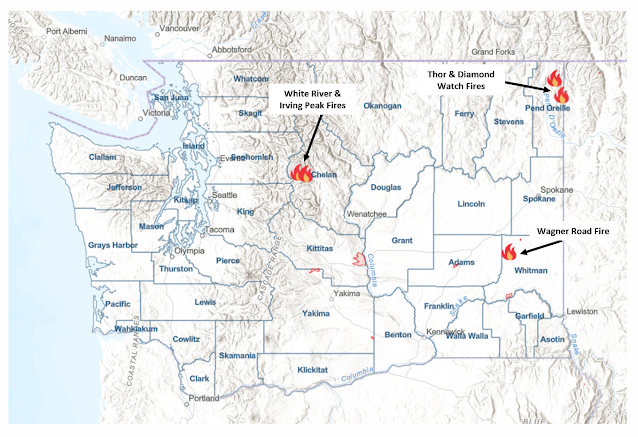
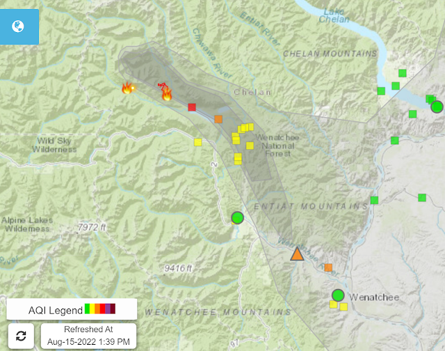
AQI values in the "Moderate" category have been established across much of eastern Washington since Wednesday, with AQI's reaching sustained "Unhealthy for Sensitive Groups" levels in the vicinity of Lake Wenatchee as the Irving Peak and White River fires continue to slowly burn downward in elevation.
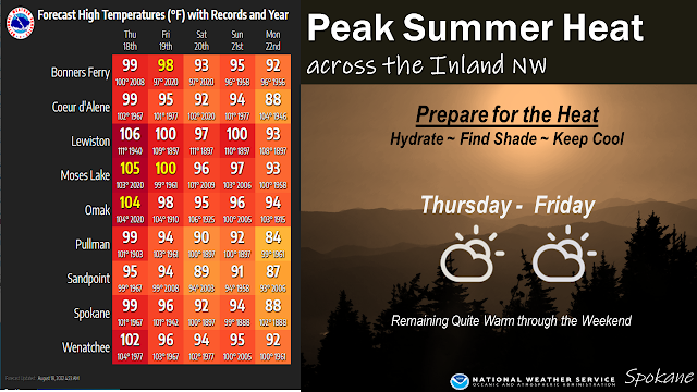
As we head into the weekend, a change in the weather pattern is on the way that should provide relief to most areas outside the Lake Wenatchee/Wenatchee Valley region. The culprit for the smoke impacts to Spokane and other areas of far eastern Washington was light north and northeasterly winds that developed Wednesday under strong high pressure conditions. Our typical westerly winds return today and will last through the weekend into early next week as a series of upper level systems work across the state.
What does this mean for air quality and smoke intrusions in Washington?
Smoke from the Diamond Watch and Thor fires, burning most of this summer in a remote portion of northeastern Pend Orielle county, will likely be cleared out of Spokane and surrounding areas as stronger westerly and southwesterly winds spread over eastern Washington tonight through Saturday morning. This pattern lasts through the early part of next week before another ridge of high pressure builds back into the region on Tuesday and Wednesday. Similar to this past week, north and northeasterly winds will return to eastern Washington and allow more smoke from the Diamond Watch fire to settle into Spokane and the Columbia Basin on Wednesday and Thursday of next week.
Smoke from the Irving Peak and White River fires will be influenced by the westerly winds spilling through the Cascade gaps through this weekend, resulting in smoke impacts being confined to Lake Wenatchee and down the Wenatchee Valley. Over the past 48-72 hours, the fire has burned downward in elevation, creating smoke below the nighttime inversion and allowing it to settle into the valleys surrounding the fire. Weather conditions over the weekend will be favorable to reduce the intensity of afternoon burning conditions, limiting smoke production, but with the fire now burning at lower elevations, smoke is more likely to hang around in the Lake Wenatchee and Wenatchee Valley through the weekend. I expect conditions to remain steady for the time being before another round of easterly upslope flow develops in the middle of next week to further trap smoke along the Cascade crest.
Elsewhere through the weekend, emerging events such as the Wagner Road fire (now at 5500 acres in Whitman County) will continue to cause local drops in air quality, as is noted at Ritzville this afternoon. Thunderstorms this afternoon in the Okanagan and North Cascades will need to be monitored for potential new fire starts.
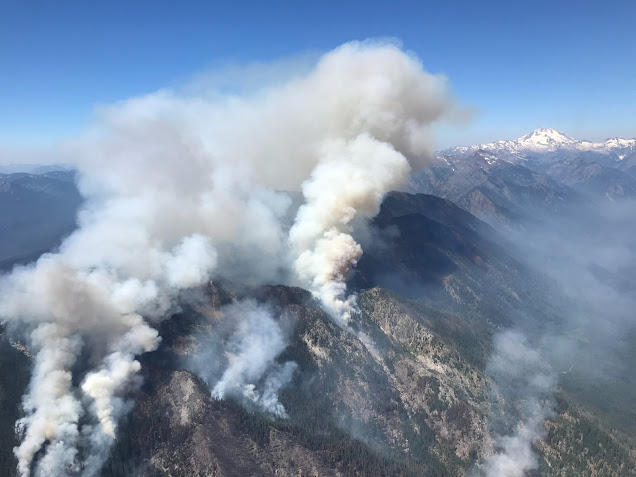
The White River and Irving Peak fires had their most active periods of burning on Wednesday as relative humidity values plummeted below 20%, a response to weak easterly upslope flow that established in response to a strong thermal trough over the Cascades and high pressure in the Columbia Basin. This weekend, the Cascades will see a return to the typical westerly flow as a series of storm systems impact western Washington. After some possible showers and thunderstorms on Monday, eastern Washington will see a return to a pattern similar to what we saw Wednesday of this week, potentially starting another round of more active burn conditions.
Photo of the White River Fire during the active burning period on Wednesday.
Courtesy NWCC.
Matthew Dehr
Wildland Fire Meteorologist
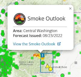 We're also excited to introduce another new feature to the WASmokeblog. Now, the Local Smoke Outlooks can also be accessed directly from the map.
