Thursday, September 29, 2022

Cascade wildfires still showing moderate fire behavior

Cloud cover has been widespread across the region recently, bringing some welcome moisture and cooler weather to parts of the state.  Unfortunately, those clouds also masked active fire locations and our ability to see smoke in satellite imagery.  Despite the recent rain in parts of the state, it wasn't strong enough to put out our wildfires. The NWCC Morning Brief today notes several fires in the Cascades that still are exhibiting moderate fire behavior: Goat Rocks, Bolt Creek, White River & Irving Peak, Minnow Ridge, and Kalama fires.  There is also minimal fire activity in the NW Pasayten Complex and Chilliwack Complex.

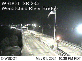
Residents in Wenatchee, Leavenworth, Methow Valley, and surrounding areas have been living with Moderate to Unhealthy smoke intermittently for many days, and will continue to get impacted by wildfire smoke today.  Visible smoke is still evident this morning on the Wenatchee and Winthrop webcams. Winds through the Cascade gaps today will be breezy but cooler temperatures should limit fire growth.  There should be fewer smoke intrusions over the weekend but areas close to fires will continue to be impacted.

Tomorrow the winds will start to transition and come from the east, with smoke impacts in the mountain valley areas West of the Cascades expected for several days.  The Puget Sound lowlands should also expect intermittent smoke from the Cascades through the weekend and into next week.  If recent trends are any indication, residents along the Skykomish river drainage (King/Snohomish county border) should especially expect Moderate to Unhealthy impacts for several days.

Temperatures will warm this weekend into next week and offshore flow is likely, but appears to stay light through the weekend.   Most models show continued warm and dry conditions through much of next week, so we should expect moderate fire activity to continue. The good news is that there isn't enough fire activity to cause a large widespread regional smoke event.  However, fresh smoke will continue to meander around the Cascades for the foreseeable future, as no rainfall (other than today's leftovers) are expected over the next week.

Current Weather Story:


Saturday through Wednesday Weather Story:


Monday, September 26, 2022

Warm and Dry through Tuesday, Improving Weather for Wednesday

 Dry and unstable conditions over the Cascades are leading to increased smoke 

The ridge of high pressure responsible for our warm and dry weekend is peaking in strength today, bring warm and dry conditions to much of the state. Over the active fires in the Cascades, unstable conditions have developed which leads to much more active burn periods in the afternoon hours. Coupled with light winds and cool nights, smoke can easily get trapped in valleys and drainages on both sides of the Cascades. 

The image below depicts where smoke settled last night on fires in the central and north Cascades:


The ongoing fires in the Cascades are responding to the warm, dry, and unstable conditions today by burning quite actively this afternoon, producing more smoke than they have in at least two weeks. The National Weather Service has issued Red Flag Warnings for the Cascades above 2,000', where fuels are dry and conditions are right for fires to experience rapid growth. 

The image below depicts where active fires are depositing smoke this afternoon:


Smoke will continue to impact eastern parts of the Puget Lowlands through Wednesday morning, when westerly winds will push in from the coast with rain chances increasing. Areas in the Cascades, namely the towns along Hwy 2, Hwy 12, and in the Wenatchee Valley, will continue to see smoke impacts through Thursday afternoon. The cold front will drive strong westerly winds through the Cascades on Wednesday, with chances of rain increasing by Wednesday night. Rain is likely to fall on all fires in the Cascades between Wednesday night and Thursday morning, ending the smoke impacts for at least a day or two. 

Another ridge will take shape over Washington on Friday and will continue through the weekend, with weather conditions being very similar to what we saw this weekend. Smoke impacts will likely crop back up in that timeframe, but with the wetting rainfall, air quality degradation will be limited to areas closest to the active fires. 


Wednesday, September 21, 2022

It's back, the three-peat we didn't want...

Third time is definitely not a charm on this one... Another plume of smoke, mostly from the Bolt Creek fire, pushed west over the north Seattle/Snohomish county area overnight and early morning. It started off a bit above the ground, as can be see from our vertical lidar (smoke radar-like) in Marysville. See the figure below. The smoke is the dark grey and yellow from about 500 m high up to 2000 m, starting 10 or 11 pm and continuing to the right on this figure. The yellow shows some especially thick plumes...

We can see the situation in the morning from the satellite, the smoke has spread over much of the central Puget Sound. Though apparently not all has mixed down to the surface.

All of this has led to some fairly high and sharp spikes in fine PM for Snohomish County and west/northwest King County as of about 9-10 AM. Many areas are seeing Unhealthy for Sensitive Groups (USG) and at times, Unhealthy AQ. Here's a recent screen grab (10 AM) from the PSCAA sensor map:


We're expecting a decent westerly and northwestly to pick up this morning and into the afternoon. This should push the smoke back to the east and south, and clear out the area by late afternoon. I'm hoping  there's not too much more smoke aloft or upwind of us so the clearing can be fairly rapid, but it's tough to tell. 

So, if you're in the USG or Unhealthy areas, limit time outside and avoid strenuous activities. When you're inside, keep windows and doors closed and find a way to filter your indoor air. See this guidance for more information. 


Wednesday, September 14, 2022

Cool air and moist weather bringing end to smoky skies

Residents in Central and Eastern WA welcomed the cleaner air today, as the lingering smoke from the past few days has mostly cleared out.  The cool air and moist weather is expected to continue in the coming days, with little fire activity expected across the region.  Residual smoke along the WA/ID border should continue clearing today and tomorrow.  All air quality alerts across the state will expire today, except for Chelan county which was extended until 8 am on Friday.  Unfortunately, Chelan county is still seeing moderate fire activity in their area, and fresh smoke is affecting towns like Plain, Leavenworth, Cashmere, Wenatchee, and Quincy.  

There seems to be a running trend the past few years, where strong easterly winds contribute to a large smoke event in September, followed by several days of lingering smoke across the entire region.  So, how bad was the smoke this summer?  Compared to previous years, it seemed like there were less smoky days, but we definitely had some pretty bad days later in the summer.  Check out the monitoring data comparison:

Western Washington experienced "typical" air quality for the summer, with just 3 days in the USG to Unhealthy range, on average.


Central Washington appears to have experienced less smoky days than normal, despite being closest to the largest forest fires in our state.  


Eastern Washington also experienced less smoky days than normal.

The summer isn't quite over yet, and there will likely be a couple more Moderate and USG days in the mix for parts of Central and Eastern WA, but it looks like we had an average to below average year of wildfire smoke.  This makes sense, given that the fire season got off to a late start and our large fires didn't get too bad, compared to previous years.  The Chelan County monitoring timeline for 2022 summarizes our smoke season pretty well:


  Enjoy the cooler weather as we transition to autumn!

Monday, September 12, 2022

Easterly winds are over, but clearing will take time

Residents in Western WA are thankful the easterly winds have ended, and the smoke has mostly cleared out.  

However, unhealthy smoke continues to persist in Central and Eastern WA, and it will take time for regional clearing.  An Air Quality Alert for all of Central and Eastern WA is in effect until 1 pm on Wednesday (9/14/2022).

This week the cool temperatures and rising humidity should bring periodic light mountain showers, which could help to reduce fire activity in the Pasayten Wilderness and North Cascades region of WA. Winds will be light but general westerly flow should improve air quality in most locations over the next couple days. There is below normal potential for new significant fires or growth.  

Residents who live near fires in Chelan, Douglas, Kittitas, and Okanogan counties will have to continue to live with any fresh smoke that is generated from local fires.  Please see the Local Smoke Outlook tab for area specific forecasts provided by the ARA for North Central WA.  Other mountain-valley communities on the western slopes of the Cascades may also smell smoke in the cool hours, due to smoke drainage.  The Health Information tab on this blog has lots of information about how you can protect yourself from smoke.  

Satellite imagery is filled with clouds today, but smoke and fire locations are generalized in the NOAA HMS image below.  Note that some fire locations in the Cascades aren't showing up since cloud and smoke coverage were too thick.

NOAA Hazard Mapping System smoke and fire locations (Monday, 9/12/2022)


Saturday, September 10, 2022

Bolt Creek Fire near Skykomish Threatens Unhealthy Air Quality for North Puget Sound

Emerging incident in Cascades, ongoing Goat Rocks Fire, and Oregon's Cedar Creek Fire spreading significant smoke in Washington

A new wildfire is emerging just north of Skykomish along Highway 2 in the Washington Cascades. With the Goat Rocks Fire experiencing significant growth yesterday, both HWY 2 and HWY 12 are closed near Steven's Pass and White Pass, respectively. Weather conditions through this morning will support rapid fire growth on all active fires in the Cascades, increasing smoke production and endangering the communities of Grotto and Packwood. 

Thick mid-level smoke from the Cedar Creek Fire in Oregon is being pushed northward by shifting mid-level winds, and will overspread western Washington from south to north today. This smoke is elevated above ground level and should not contribute significantly to further reductions in air quality, but will actually help keep temperatures down a few degrees this afternoon and limit the minimum RH values experienced in the Puget Lowlands. 

Air quality impacts will primarily be driven by the Goat Rocks Fire and the Bolt Creek Fire through today on the westside, with smoke from fires in Idaho and Montana driving the air quality degradation on the east side. Large areas of "Unhealthy" air quality are likely to develop across the state this afternoon, with the worst air quality being along HWY 2 and HWY 12, in Snohomish and Lewis counties, and in the southeastern quarter of Washington, including areas near Spokane southward to Walla Walla. 


Conditions will begin to improve for western Washington on Sunday, with Monday seeing a return of "Good" air quality for most areas west of the Cascade crest. Poor air quality will linger across eastern Washington into Monday, but will improve through the week.  

Wildland Fire Meteorologist Matthew Dehr

Friday, September 9, 2022

9/9/2022 East Wind Event Ongoing: Friday and Saturday See Peak Fire Danger

First critical fire weather event of 2022 for western Washington

Fire danger is peaking this weekend across most of Washington, with a critical East Wind event taking shape across the Pacific Northwest. After a week of high fire danger east of the Cascades, western Washington is experiencing widespread critical fire weather today, and conditions will remain critical through tomorrow evening. Relative humidity values across the state will drop into the 15-25% range, with sustained winds of 15-25mph common both east and west of the Cascades. The highest wind gusts will be in the Columbia Gorge and through the Cascade Passes, where isolated gusts of 40-50mph are possible. As active fires continue to burn and new fires emerge, heed local emergency official's orders about evacuations and remain vigilant! 

Active fires producing smoke for much of the state

A northwesterly wind brought smoke and hazardous air quality to the Methow Valley and Lake Chelan from the Chilliwack and Pasayten Complexes in the North Cascades. This morning, a shift in the winds from the northwest to the northeast have redirected smoke from these fires to the west side of the Cascades, with Whatcom and Skagit Counties seeing the most immediate impacts. As the East Wind event continues to unfold, smoke will work southward toward King County and the rest of the south Sound region. Smoke from fires in eastern Washington, Idaho, and Montana will drift toward the Columbia Basin and east slopes of the Cascades.


Air quality impacts expected for the Puget Sound region and eastern Washington

Conditions have improved from Hazardous to Moderate for the Methow Valley and Lake Chelan area this morning, and will continue remain steady for the next 24-48 hours. Air quality is currently Unhealthy for the Wenatchee Valley and along the Skagit River. Moderate air quality is observed over much of the Columbia Basin this morning, and will likely deteriorate slightly over the next 24-48 hours as smoke from fires in Idaho and Montana continues to stream westward. 

Air quality in the Puget Lowlands is generally good this morning, but signs of degradation are present in Whatcom and Skagit counties. Air quality will deteriorate across the west side of the state through this afternoon and tonight as smoke from the fires in the North Cascades continues to pour over the crest of the mountains. Any new fires that develop over the next 24 hours will impact air quality significantly, so it is important to continually monitor your local air quality and take precautions based on the figure below!

Air Quality Index
See full guidance for more info.

DNR Wildland Fire Meteorologist Matthew Dehr

Wednesday, September 7, 2022

9/7/2022 More smoke on the horizon

Yesterday saw minimal fire growth throughout the state and region with calmer winds and lower overnight temps.  As a result, less overnight smoke production occurred.  Monitors are mostly green across the state today, but some near-fire smoke effects are still being seen at Wenatchee Lake, NE Washington (e.g. Pend Oreille county) and in the Lewiston-Clarkston valley.  

The National Weather Service has issued a Red Flag Warning for all counties east of the Cascades crest.  A Red Flag Warning means that critical fire weather conditions are occurring with a combination of strong winds, low relative humidity, and warm temperatures which can contribute to extreme fire behavior.  It should cool off tomorrow a bit as a cold front moves through, but it will remain windy and we expect another round of heat this weekend.  Winds from the NW will prevail today and tomorrow, but a shift will occur on Friday, with predominant winds expected from the east.

Recent fire activity is shown in the map below, with considerable smoke expected to continue from the North Cascades (WA) and Wallowa Mountains (OR).  For specific wildfire information near you, see the Inciweb map.  We don't expect any smoke impacts in WA from the Wallowa Mountain fires for the next couple days, but they will probably affect SE WA over the weekend.  Smoke from the Cascades fires are expected to impact Western WA on Friday.  Fire activity near Lake Wenatchee has decreased, but prevailing winds will continue to push a little smoke into the greater Wenatchee region today and tomorrow.

If you are impacted by smoke in your area, you can reduce exposure by limiting outside activity, staying inside with cleaner indoor air, finding other clean-air spaces, or wearing an N95 mask.


Recent Fire Activity (9/7/2022)

Thursday, September 1, 2022

9/1/2022 Statewide smoke update - More heat and smoke expected

Air quality has deteriorated the past few days in North and Central Washington, with especially active new fire development in the Cascades.  The Wenatchee region and Methow Valley have had the worst air quality lately, with fresh smoke pooling in valleys.  There is also fresh fire activity in NorthEast Washington, with visible smoke North of Spokane.  In general, it should be windy enough this weekend to prevent any long-term build-up of smoke, but smoke impacts will continue to be a problem.

PM2.5 Measurements at Maple Falls, Twisp, Leavenworth, and Wenatchee

Late Friday into Saturday will bring breezy winds, with possible mountain thunderstorms, and the potential for fire spread. Hot, dry conditions will set up ahead of the winds, with Friday set for near-record heat. Temperatures will cool a little over the weekend, but remain above normal.   The expected dynamic weather expected this weekend will give rise to dynamic smoke impacts.  Recently active fire locations are shown below:

Recent fire locations in and around Washington State

Smoke forecasts are not confident during these periods of dynamic weather and new emerging fire growth.  Looking at one member of the Dept. of Ecology HYSPLIT forecasts, we see a few key features that have reasonable confidence:

  • Smoke in Central WA should mostly clear out on Friday, but Saturday will bring Moderate to Unhealthy smoke back to the Methow Valley and Wenatchee areas.  Winds should disperse any lingering smoke, but expect to keep smelling smoke on the following days.
  • Smoke on Friday in SouthEast WA (e.g. Asotin, Garfield, Columbia, Walla Walla counties) is expected from the fires in the Blue Mountains, this should mostly clear out on Saturday though.
  • Inland Western Washington will likely get some lingering smoke from the Cascade fires on Monday, pooling smoke in mountain valleys.  Winds should push that smoke back east though, and shouldn't last long.
HYSPLIT Forecast of Smoke for Labor Day Weekend

The 5-day forecasts available on the Smoke Blog map are automatically updated based on multiple smoke forecasts.  Expect changes in predictions as weather forecasts and new fire locations get ingested into nightly simulations.

You can find resources on how to protect yourself from smoke impacts on the Health Resources tab.