Thursday, August 31, 2017

Intermittent smoke from Washington fires expected

Smoke from Oregon has finally stepped aside and now we are only left with our own smoke to deal with.  There has been a lot of clearing, though, with the breezy conditions, which is nice to see.  Winds are pushing smoke southeast but the plumes have been meandering back and forth a bit, impacting communities intermittently.  This will continue through the weekend.  

Smoke from the Diamond Creek fire has been creating Moderate to Unhealthy for Sensitive Groups air quality from Omak all the way to Spokane. Smoke will continue to affect air quality in the upper Methow Valley, but the Spokane area should get better tonight.  Though, some light smoke may meander its way back again tomorrow afternoon.

The Norse Peak fire and Jolly Mountain fire will continue to impact communities around Yakima and Ellensburg, and even the Tri-Cities intermittently.  Unfortunately Ellensburg area is caught in the middle of those two fires and will continue to see patchy smoke through the weekend.

The Uno Peak fire around Safety Harbor is small but producing a visible plume.  Fire crews are working to to put it out, but there is potential for fire activity to grow over the weekend.  Expect some light to moderate smoke to drain down in the Lake Chelan area during the cool part of the night.

All in all, the Labor Day weekend will be hot and dry and if you are downwind of a local wildfire, expect to see light to moderate smoke from time to time.


Wednesday, August 30, 2017

8/30/2017 Air Quality Monitoring Deep Dive

This post is meant as an explanation of how to better understand some details of the air quality monitoring information you see as colored dots on the smoke blog map and on the Washington Dept. of Ecology air quality map (available at https://fortress.wa.gov/ecy/enviwa/Default.htm). See the questions in the boxes on the image below. Read on if you'd like to know the answers.


1.  Why are the dots over Malaga and Quincy on the WA Ecology air quality map showing good (green) air quality when others nearby are red or orange?

Answer: Most of the dots on the Ecology map show air quality conditions for PM2.5 (fine particulate matter) which is a really good indicator of how much smoke is in the air, but some of the dots represent monitors that measure a different component of air quality. The monitor in Malaga measures SO2 (sulfur dioxide), and the monitor in Quincy measures NO2 (nitrogen dioxide) neither of which are significant components of wildfire smoke. There are also a few monitors around the state that measure O3 (ozone) including one north of Spokane that is green right now whereas other monitors nearby are orange or yellow. Ozone levels can go up due to wildfire smoke but generally not until late in the afternoon.

You can find out what is being monitored at a site you are interested in by clicking on the colored dot on the Dept. of Ecology air quality map (https://fortress.wa.gov/ecy/enviwa/Default.htm) and then on “View Site Information” in the next pop-up box as shown in the figure below.

Note: All monitors shown on the Smoke Blog map are PM2.5 (fine particulate) monitors.

How to find out what pollutant is being monitored at a location on the Dept. of Ecology map.

Most monitoring sites on the Dept. of Ecology map measure PM2.5 but not all.
2.  Why do the two maps (Dept. of Ecology vs. Smoke Blog) show different warning levels for the same locations as in the example in the first figure where Ellensburg is orange on the Ecology map and yellow on the Smoke Blog map?

Answer: There are two different air quality warning indices in action here – the WAQA vs. the AQI. The federal Environmental Protection Agency developed a scale called the Air Quality Index (AQI) that applies across the country. Washington Department of Ecology wanted an index that was more protective of public health so they developed the Washington Air Quality Advisory (WAQA) that warns the public of possible health risks at air pollution concentrations lower than the AQI. So if the two maps are showing different warning categories, the WAQA scale will warn of greater health risk than the AQI. 
3.  Why are some monitoring sites indicated by triangles on the Smoke Blog map but don’t appear at all on the Dept. of Ecology map?

Answer: The Forest Service has invested in a national cache of portable air quality monitors that can be sent to communities that are impacted by smoke but not represented by state monitoring networks. In Washington at the moment we have one of these monitors in three small communities: Mazama, Tonasket, and Metaline Falls. These sites show up on the Smoke Blog map as triangles but do not appear on the Dept. of Ecology map.

Department of Ecology also has some mobile monitors to deploy when needed. Currently they have mobile monitors placed in White Salmon, Cle Elum, and Newport. The Dept. of Ecology mobile monitors show up on both maps as circles so are indistinguishable from other monitoring in the state although the sites will eventually be removed when the risk from smoke is over.
The picture below shows the portable air quality instrument that was deployed in Mazama near the Diamond Creek fire. Learn more about the instrument and how it is used at the video available here: https://inciweb.nwcg.gov/incident/photograph/5409/21/ 


When will this smoke go away? Not yet!

Smoke from Oregon continues to get pushed over central and eastern Washington, but this should get out of the way late tonight to make way for smoke from local fires.  As winds from the Northwest push their way through the state tomorrow, there should be some very brief relief from smokey air in eastern Washington communities like Moses Lake and possibly even Spokane.  Unfortunately, smoke from the Jolly Mountain fire and Norse Peak fire will quickly fill that void tomorrow evening.  Plumes from the Diamond Creek fire are also expected to meander a bit and contribute to smoky conditions around the Colville reservation and further downwind.

For communities like Yakima, Ellensburg, and Tri-Cities, the smoke from Oregon will quickly be replaced with smoke from our own state so you may not even notice a difference over the next couple days.


Tuesday, August 29, 2017

Overnight Smoke Forecast for Central WA


North Central Washington
The Diamond Creek fire will place a moderate amount of smoke into the Okanogan River valley, but that should not last long as the continued northwest winds should provide some level of relief from poor air quality all the way through Friday am.  The forecast after Friday looks good for Okanogan County and points east, as the heat should help the smoke plume to rise out of valleys.
Central Washington:
A wind shift is upon us (high winds 15+ mph forecasted out of the NW) – which will bring smoke from the Norse Peak Fire and Jolly Mountain Fire to the communities downwind tonight and continue to do so into Friday. Good news/ bad news - Lots of mixing forecasted, with the strong wind and high day time temperatures: The winds should relieve smoke in most areas except for the downwind communities of Cle Elum, Ellensburg, Yakima (both upper and lower valley) Naches, Tieton, and Southern Columbia Basin including Tri-Cities… and onward to Walla Walla.  Hopefully the Upper Columbia Basin communities (Moses Lake, Ephrata) and Eastern Washington will have a decent break from the smoke through the work week…

Communities in the lower Columbia Gorge ( White Salmon, Bingen, Lyle, Dallesport ) should get relief from the smoke coming from central Oregon, as northwest winds are forecasted throughout the work week will keep the Columbia Gorge somewhat smoke free until southerly wind returns sometime late this weekend.

Winds are forecasted region wide to be 15 mph steady, gusting into the 25mph range and increasing mid-day on Wednesday. The winds return again all day Thursday and into Friday. NOTE- The strong winds and increasing heat mean more emissions from rapid fire spread so please stay aware of changing conditions.

Smoke on the west side should start clearing late tonight. No such luck in eastern WA

Satellite imagery shows impressive plumes from fires in the Cascades headed northeast.


But it requires a look at a zoomed out loop to see the culprit behind all the smoke in western WA: smoke from southwestern Oregon that moved over the Pacific and is now swinging over us as it departs to the east. Most locations along the I-5 corridor are reporting Moderate to Unhealthy for Sensitive Groups (USG) air and that will remain the story for the rest of the day. A surge of marine air is expected late tonight and it might be Wednesday morning before smoke starts to clear. Sensitive individuals should take precautions and minimize their outdoor time.

After that, western WA should remain mostly smoke- free through Friday, when things start getting messy again. Please stay tuned.

Eastern WA forecast
Kinda "pick your poison" scenario. Right now the central Basin is getting battered by Oregon smoke, far southeast WA getting Idahoan smoke, and north central WA getting doses from of the Norse Peak, Jolly Mountain (cool name, bad smoke) and the Diamond Creek fires. As winds shift tomorrow evening, there will be some short-lived relief through about Thursday evening, with the Lewis- Clark valley being the last to clear out. Areas closer to the fires like Cle Elum, Ellensburg, Yakima, Leavenworth, Wenatchee, the Methow, Newport and Metaline Falls will likely see USG air for longer  and may not drop below Moderate, due to close proximity to fires.

After that local fires start back where they left off, taking over the business of tormenting Washingtonians by flooding the Columbia Basin with smoke again. Not expecting much better than Moderate air - with USG areas being common- in eastern WA between now and the weekend. An air quality alert has been issued to cover this.

Monday, August 28, 2017

8/28/2017 Smoke model predictions for air quality in Washington

The BlueSky smoke model is useful for visualizing where smoke from wildfires will travel and how intense concentrations on the ground will be. Predictions for today (Monday) at 5pm are shown in the first image below. Smoke from the Jolly Creek fire is likely to impact the Cle Elum area most significantly but diffuse smoke is also present throughout the Wenatchee, Ellensburg and Yakima areas. Smoke from Diamond Creek, Bridge Creek, and Noisy Creek fires is traveling mostly to the north.

Smoke prediction for 5pm Monday (
 The prediction for 6am Tuesday morning is shown below. Smoke is more concentrated in the low valleys and once again, Cle Elum is likely impacted, and to a somewhat lesser degree, Ellensburg, Leavenworth, and Wenatchee.
Smoke prediction for 6am Tuesday 8/29
By noon tomorrow (Tuesday) smoke looks to become a bit more widespread but not too terribly thick. Smoke is drifting to the north and north east.
Smoke prediction for noon Tuesday 8/29 
Smoke conditions at 5pm Tuesday (below) look similar to 5pm today although there is more smoke accumulating throughout the Yakima Valley.
Smoke prediction for 6pm Tuesday 8/29
And the final image of the modeling run shows smoke heading more directly to the east with possible additional impacts farther away in Moses Lake, Vantage, and Richland.
Smoke prediction for midnight Tuesday 8/29

8/28/2017 Washington wildfires update.

We have two fairly active fires in Washington right now - Jolly Mountain and Norse Peak (which also includes the nearby Union Creek and American fires), plus a few other fires that are causing smoke impacts more locally, especially Diamond Creek in the Methow Valley area. Here's the latest summary of active wildfires in Washington.

Overview of wildfires in Washington on 8/28/2017

Details of Active fires in Washington. Follow the links in the Notes column for more information.
Fire(s)
Acres
Percent contained
Notes
Diamond Creek
32,257
58%
Minimal perimeter growth is expected on the fire’s northeast side. Interior burning of green islands within the fire’s perimeter will continue.
Quarry
100
0%
The fire is burning in steep, heavily forested country on the Mt. Baker Snoqualmie National Forest 30 miles NW of North Bend.
Jolly Mountain
4,402
0%
The fire was active Sunday on the west and south flanks. Steep, rugged topography and numerous standing dead trees in the fire area has necessitated use of indirect fire suppression tactics. 55,000 gallons of water were dropped on the fire yesterday by helicopter with an additional 30,000 gallons dropped from scooper planes.
Norse Peak,
Union Creek, American
2,222
355
222
8%
SR 410 remains closed from Chinook Pass (MP 69) to Hell’s Crossing (MP 84). The highway will reopen at 8:00pm for nighttime travel only and close again at 6:00am.
Scatter Creek
384
80%
The fire exhibited little activity yesterday. Engine crews are patrolling the burned area and extinguishing remaining hot spots.
Bridge Creek
3,440
42%
The intensity of the main body of the fire has lessened over the last few days, slowing its spread to the north. Burnout operations and natural ignitions are consuming unburned areas.
https://inciweb.nwcg.gov/incident/5490/
Noisy Creek
4,000
75%
Fire control lines or natural barriers surround the entire fire. https://inciweb.nwcg.gov/incident/5388/


Some details below of the fires that are most active and currently sending up the most smoke.

Smoke from the Jolly Mountain fire impacting Leavenworth, Wenatchee, Cle Elum, Ellensburg, and surrounding areas. In addition, some of the smoke is heading West towards Puget sound.
A close up look of the Jolly Mountain fire permiter
There is a cluster of fires causing problems for travel on highway 410 - Norse Peak, Union Creek, and the American fires in particular (below). These fires are also impacting air quality around Yakima and Naches, and sending smoke west towards the southern part of Puget Sound.
A close up look at the Norse Peak fire perimeter and other nearby fires
And finally, the persistent Diamond Creek fire (below) continues to impact air quality in the area of the Methow Valley.
A close up look at the Diamond Creek fire perimeter.

Sunday, August 27, 2017

Smoke gradually closing in on Seattle. Also see the smoke comparison with previous years

West side forecast
This morning's satellite image shows smoke from the Jolly Mountain fire gradually closing in on Seattle.


Most of it is staying aloft for now but will likely mix to the surface between now and Monday night. Expect air to be Moderate to Unhealthy for Sensitive Groups from about North Bend to West Seattle and down to Tacoma or Olympia. Areas north of Seattle should remain mostly Good.

West winds will help clear things out by Tuesday but the respite may be short lived. There is also a Red Flag Warning for the Cascades until Monday night so please stay tuned.

Eastern WA forecast
Several fires continue to pump smoke into the Columbia Basin and most monitors around the Basin rarely saw anything better than Moderate air all weekend. As the satellite image above indicates, some California/ Oregon smoke that initially blew over the Pacific ocean is starting to stream over southern WA. Most of this smoke is expected to remain aloft. In general, air quality across a lot of eastern WA isn't expected to be much better than Moderate until Tuesday. Cle Elum could see intermittently Unhealthy conditions due to the proximity of fires.

Some new air quality monitors have been installed in Metaline Falls, Cle Elum, White Salmon and Newport. Due to telemetry issues which we are working on, only the Metaline Falls data are showing up on the map above. Other 3 monitors can be seen on Ecology's air quality monitoring map.

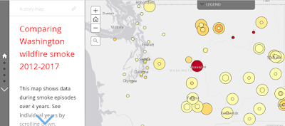
Comparing wildfire smoke impacts across 4 recent summers

http://www.arcgis.com/apps/MapJournal/index.html?appid=07157b510ca24f498425585be3d387e0
Have a look at this interactive StoryMap showing how wildfire smoke episodes impacted different areas in the state since 2012. Clicking on circles will display more site- specific data. The main take home messages are:


  • Variable smoke impacts in different areas and years. See how your community compares with those of your fellow Washingtonians.
  • Very widespread smoke this year affecting a lot more people.
  • And a lot more.
2013 and 2016 were not "major" wildfire years so are not included.

Friday, August 25, 2017

We'll get a dose of our own smoke this weekend. Ozone is a concern too

No blaming Oregon or British Columbia this time. High pressure that is starting to build will shunt Oregon smoke to our south this weekend. And there doesn't seem to be a whole lot of smoke to our north in BC, to affect us like it did earlier. So the smoke Washingtonians will be breathing this weekend will be mostly from in-state fires.

Here are the forecast plume trajectories from Oregon, at 150ft, 1500ft and 4500ft above. All headed away from us for the next 36 hours.


And the same situation for BC smoke:


Smoke forecast for eastern Washington

The Columbia Basin and far southeast WA will continue to have air quality that is Moderate and Unhealthy for Sensitive Groups (USG). The Methow Valley will have USG air at times, as will Colville and Newport. All thanks to the smoke that is already lodged in the area (conditions are mostly Moderate and USG now) and the continued supply of new smoke from the many fires burning around eastern WA.

Smoke forecast for western Washington
By Sunday morning, the models are hinting at a very light east wind across the Cascades and this could cause some smoke from the Jolly Mountain fire to drain into the Seattle area. Not a killer smoke event but Moderate or USG conditions are possible if it pans out. Rest of western WA is expected to remain Good.


Ozone (aka ground level smog) forecast on both sides of the Cascades
The Tri Cities and eastern Cascade foothills of King and Pierce Counties could see Moderate or USG levels of ozone this weekend.

Health consequences of smoke and ozone are explained elsewhere. Please take necessary precautions depending on your health and exposure.

In summary, if you're in eastern WA, don't expect any major relief from the smoke for 3 days at least, possibly longer. If you're in the Seattle area, enjoy the Good air while you can.

Wednesday, August 23, 2017

And now its Oregon's turn to send a smoke monster our way

But it is still a minnow compared to the Canadian fellow who visited three weeks ago.

 Most of the smoke models did not and still don't expect Oregon smoke to hit central and eastern Washington. Here's the satellite picture from Tuesday afternoon showing how that crafty monster outwitted them.


Air in eastern WA has degraded slowly over the work week, as recorded by the monitors.


Air quality was mostly Moderate- Unhealthy for Sensitive Groups in much of eastern WA yesterday. Not all the smoke is caused by Oregon fires. Several fires in central, northern and northeast WA are adding to the mix. Fires in Thurston and western Kittitas counties caused Moderate air in Olympia and eastern King County, respectively last evening.

Forecast 
Air quality has returned to mostly Good in western WA is expected to remain that way through Friday at least. There will be some relief across eastern WA starting late tonight and lasting until Friday morning as a front moves through, giving rise to- yes, you guessed it- stronger southwest winds (= more Oregon smoke but also better dispersion) and greater fire danger.

Winds die down by Saturday as high pressure builds over the state to give us nice weekend weather. And poor smoke dispersion. So for most of eastern WA, the forecast will be for Moderate air on Wednesday, Good air on Thursday and back to Moderate air by Friday. Areas closer to fires will likely experience conditions that are Unhealthy for Sensitive Groups at times.

High pressure will likely be the "No Entry" sign for Oregon smoke over the weekend, thwarting the monster's spawning powers a bit. But there is a chance that some smoke from eastern WA wildfires could get caught up in east winds and make it over to western WA. Stay tuned, we're monitoring this situation.

Sunday, August 20, 2017

Smoke in NE Washington and along portions of the path of totality

Smoke forecast
Smoke from fires in north and northeastern WA continue to impact areas north of a line drawn from Spokane to Chelan. Air has been mostly Moderate in these areas with worse conditions closer to fires. Some clearing occurred this afternoon but winds will die down overnight and remain light until Wednesday, causing smoke to slosh back and forth. The Methow Valley, Omak, Colville and Newport are likely to see air quality degrading to Unhealthy for Sensitive Groups, while the Spokane area is likely to remain Moderate. In general, some daytime clearing followed by poor air from evening until the next morning.

Smoke and the eclipse
Fear not, the eclipse (or partial eclipse, depending on location) will still be visible through the smoke as long as clouds don't get in the way. Smoke won't be as dense as it was when this picture was taken about 2 weeks ago. The sun's corona is bright enough to be seen through the smoke layer.


The fine particle pollution forecast from WSU's AIRPACT model for the 24 hours ending at noon on Monday, is shown below. The approximate path of totality is annotated in purple. Partial obscuration of the view can be expected in some spots west of the Oregon Cascade crest and southwestern Idaho. 


And finally, the National Weather Service says shallow morning clouds will be present in the Puget Sound region tomorrow morning, but should start to burn off between 9-10AM. Areas above 500' elevation should be clear, as will the rest of the state. Enjoy the eclipse!

Friday, August 18, 2017

Strong Winds with More Fire Risk and some local smoke for Central and Eastern WA

The National Weather Service has issued a Red Flag Warning for the Central Cascade Valleys for this afternoon, with winds from the west forecast to to gust up to 35 mph.  This can lead to rapid fire spread for any new or existing fires.  The Monument Hill brush fire near Quincy was contained yesterday, but not before it destroyed two homes and other structures/equipment.  Please take extra precaution and delay any planned open burning, especially the areas around Chelan/Wenatchee/Moses Lake.

Expect relatively small smoke plumes from local fires to continue over the weekend. Light smoke from the Norse Peak Fire will continue to be seen around the Yakima area this weekend, especially in the evenings.   The Diamond Creek fire continues to be a problem and light to moderate smoke should be expected around Winthrop over the weekend.  The Noisy Creek Fire will also continue to produce light smoke, which has been seen over the eastern part of the Colville Tribe Reservation.

Smoke from the BC fires will make its way down to NE WA, with moderate air quality expected in Ferry, Stevens, and Pend Oreille counties on Saturday afternoon and through the evening and into Sunday.


Tuesday, August 15, 2017

Monday, August 14, 2017

8/14/2017 Fires in Washington update

Update on active fires in Washington

Cooler weather has helped improve statewide air quality and has assisted firefighters with their work of controlling wildfires in the state. The unstable weather also brought lightning to some areas though and a few new fires were ignited. A summary of active wildfires is shown in the map and table below:


Fire
Acres
Estimated Containment Date
Comments
Diamond Creek
26,938
10/15/2017
Expected fire behavior: long-range spotting, uphill runs, crowning, and fast rates of spread. Expected fire spread to the south and northwest portions of the fire.
Noisy Creek
4,000
9/30/2017
Moderate Backing, Creeping, Smoldering. Occasional light rain, cooler temperatures and higher relative humidity's have slowed fire activity. A warming trend will begin Tuesday.  
Bridge Creek
1,043
8/31/2017
Cooler weather and slight precipitation moderated fire behavior for a second day. Fire still making short runs with rollout debris and backing downhill.
Jolly Mountain
327
10/15/2017
Made up of five fires in a remote area approximately five miles northeast of the north end of Cle Elum Lake. Steep slopes, rugged terrain and the distance from road systems limit access to the fires. Due to the inaccessibility, firefighters are continuing to scout fire line locations with the highest probability of success to protect values at risk.
Hult Butte
400
No estimate
Six miles west of Vantage, WA. Start date 8/13/2017. 100% lined, no additional growth expected.
East Saddle
17000
8/15/2017
10 miles west of Othello, WA. 41 percent contained.
Head Water
125
8/18/2017
Crews worked through cold temperatures Sunday night to solidify containment lines, and Monday’s efforts are expected to increase containment to approximately 40 percent. Commanders expect the fire to be fully contained by the end of shift Thursday.

In addition, a few new fires are reported on the Naches Ranger district but have not yet made it into the daily summary provided by the Northwest Coordination Center. The following was the summary provided by the district:

Norse Peak and American Ridge Fires

Summary:  A lightning storm Friday afternoon ignited 13 fires within the Naches Ranger District west of Yakima, Washington.  Ten of the fires are in the William O. Douglas and Norse Peak Wildernesses.  Three of the more accessible fires were contained Friday night. 

A Sunday morning overflight indicated that fire activity was somewhat less than on Saturday; however, overall there was still enough heat remaining to produce visible smoke and continue steady, but slow fire growth.  These fires will be fully suppressed; however, difficult access and firefighter safety concerns will likely deter immediate direct action.  The strategy is to prevent these fires from coming down out of the Wilderness to SR 410 and threatening the structures and improvements adjacent to it.    

And finally, the map capture below shows the extensive area still covered by active wildfires in British Columbia. The meteorology is keeping the smoke north of the border and out of Washington for now at least. And every air quality monitor in Washington is reporting Good air quality at the moment. We haven't seen that in a long time!
Wildfires and air quality 8/14/2017

8/14/2017 Smoke forecast for vicinity of Diamond Creek fire


Friday, August 11, 2017

The end is nigh. For BC smoke, that is.

Smoke has already started clearing out of western WA but eastern WA needs another 24 hours at least before things get moving. The clearing trend will continue through the weekend so the number of smoky hours are indeed numbered. Expect air in western WA to return to mostly Good by Saturday evening, while most eastern WA locations will drop to Moderate or Good by Sunday.

Locations closer to fires will likely have worse conditions: the Diamond Creek fire and Methow Valley area will be covered by a separate post. The Metaline Falls and Newport areas have been plagued by smoke from the Noisy Creek Fire and will enjoy marginal relief. A temporary air quality monitor has been set up in Newport and will start reporting air quality conditions on the map above, shortly. Another monitor will be set up around Metaline Falls in the coming days.

Fly in the ointment (saw that coming?): The National Weather Service Graphic below hopefully says it all:


None of the weather models are advertising an imminent return to conditions conducive for BC wildfire smoke to return. At least not within the next week. However smoke from local fires and some in Oregon could continue impacting eastern WA, so please pay attention to future smoke forecasts.

Finally, here's a K-E-W-L sunrise timelapse vdo for each day over the last week, produced by Greg Johnson. Really shows what smoke does to visibility.


Outlook for Smoke on the Diamond Creek Fire 8/11/2017


Thursday, August 10, 2017

Smoke and Your Health


Protect your health while it's smoky

Breathing in high levels of smoke is bad for your health.

Exposure to wildfire smoke, like all smoke, can cause health problems that include:
  • burning eyes
  • sore throat
  • headache
  • coughing
  • wheezing
  • shortness of breath
  • worsening of heart and lung conditions
The possibility for high levels of smoke to worsen symptoms or trigger health effects for people with heart disease or lung disease is especially a concern because this can be life-threatening. Sensitive groups include:
  • people with chronic heart disease or lung disease
  • people with respiratory infections
  • people with diabetes
  • infants and children
  • pregnant women
  • people over 65
Taking precaution to protect your health from smoke is important for everyone, especially for sensitive groups of people. 

Take steps to reduce smoke exposure.

Stay up-to-date with the air pollution category in your area. Washington Air Quality Advisory table


Air Pollution Categories:

Good
Moderate
Unhealthy for Sensitive Groups
Unhealthy
Very Unhealthy
Hazardous

Smoke levels can change through the day with wildfires.
  • When smoke levels reach the category “unhealthy for sensitive groups”, sensitive groups of people should avoid time outdoors.
  • When smoke levels are in the “unhealthy”, “very unhealthy” or “hazardous” categories, everyone should limit their time outdoors, avoid outdoor exercise, and keep indoor air clean.
To keep indoor air clean, close windows and doors, but be mindful of the heat. Stay hydrated on these summer days to avoid other health problems. Use fans indoors, and if you have an air conditioner, set it to recirculate. Don’t add to indoor air pollution: avoid candle use, and don’t smoke or vacuum while it’s smoky outside. An air cleaning device with a HEPA filter can improve indoor air quality, but do not use air cleaners that produce ozone
Seek medical attention if you or those you are caring for have serious symptoms.