Smoke from the Placer Creek Fire in Southern BC is impacting communities in northeastern Washington. The fire began over the weekend and has quickly grown to 6400 acres. This morning's satellite image shows the smoke plume moving southeast.
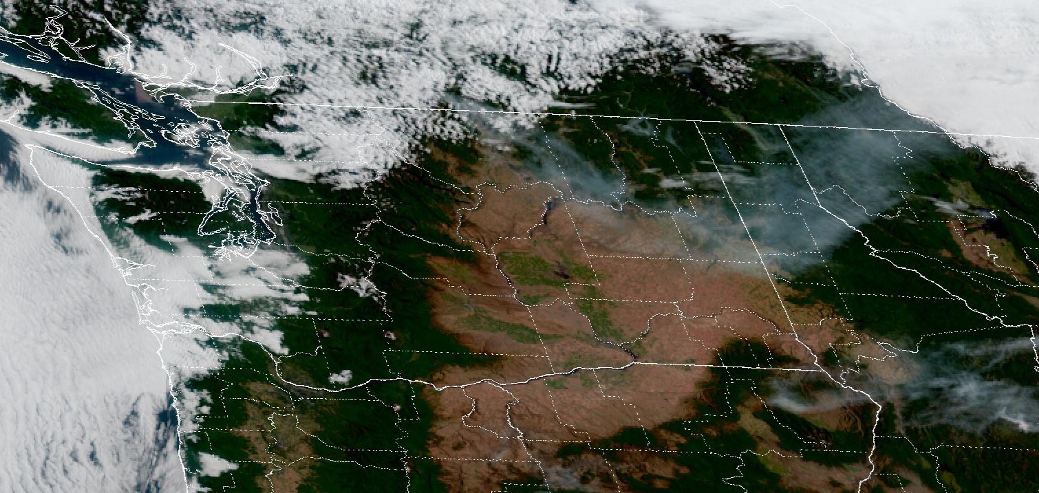 |
| GOES-WEST 14 Jul 2025 15:11Z |
Smoke is also visible west of Tonasket:
 |
| Smoke visible at Aeneas Mountain west of Tonasket. Image courtesy: DNR/Pano |
Smoke from the fire will continue to impact northeastern Washington until shifting winds this afternoon push the smoke south into the Okanogan Valley.
Smoke from the Hope and Western Pines Fires in northeastern WA continue to impact nearby communities. Firefighting efforts on both fires continue, but hot, dry, and windy conditions will challenge efforts and increase fire activity. Communities nearby to both fires should continue to expect intermittent smoke impacts. In general, most of Central and Eastern WA will observe moderate air quality over the next few days due to multiple fires in the region.
Critical Fire Weather Today
Extreme fire weather is expected this afternoon in Okanogan Valley; very strong winds (sustained winds 30-40 mph and gusts up to 50-60 mph) are forecasted for the area. The strong winds in addition to the hot and dry conditions will contribute to critical fire weather in the Okanogan Valley as well as the Columbian Basin. A Red Flag Warning has been issued for most of Eastern WA through Wednesday.
These strong north winds will transport Canadian smoke south into the Okanogan Valley. Any new fire starts will spread quickly and existing fires (including the Pomas Fire) will exhibit increased growth.
Fire weather concerns will ease Thursday with the return of westerly winds that will also help scour out any areas of poor air quality.

Western WA Smoke Impacts Tomorrow
Tomorrow winds from the northeast will push Canadian smoke into northwestern Washington (primarily eastern Whatcom, Skagit, and northern Snohomish counties). Most of the smoke will likely stay above us in the atmosphere but a fraction may mix down to the surface tomorrow afternoon leading to moderate air quality at worst. Haze may be noticeable across western Washington before westerly winds return on Thursday.
My local weather report has diminished in accuracy a lot with the firing and defunding that's being done in the current administration. Is air quality monitoring still accurate?
ReplyDeleteThanks for your comment. Yes, air quality monitoring is still accurate. Ecology and local clean air agencies continue to check and maintain monitors using standard quality assurance and quality control practices.
DeleteThank you! That is a relief! I appreciate all you are doing to help us track fires and smoke.
Deletewe're seeing and smelling it in north king county now (5:30pm)
ReplyDeleteWill you be posting more frequent updates now that smoke is here?Also the Ecology smoke forecast link does not work. Thanks for this good work!
ReplyDeleteYes--we'll post as needed as smoke impacts increase. The map at the top of this page is also always updated with current air quality conditions and the daily smoke forecast. Which Ecology smoke forecast link isn't working?
DeleteThe Washington air monitoring network smoke forecast link on the monitoring and forecast page is the one that is not working
ReplyDeleteWe'll fix that link. Thank you!
Delete